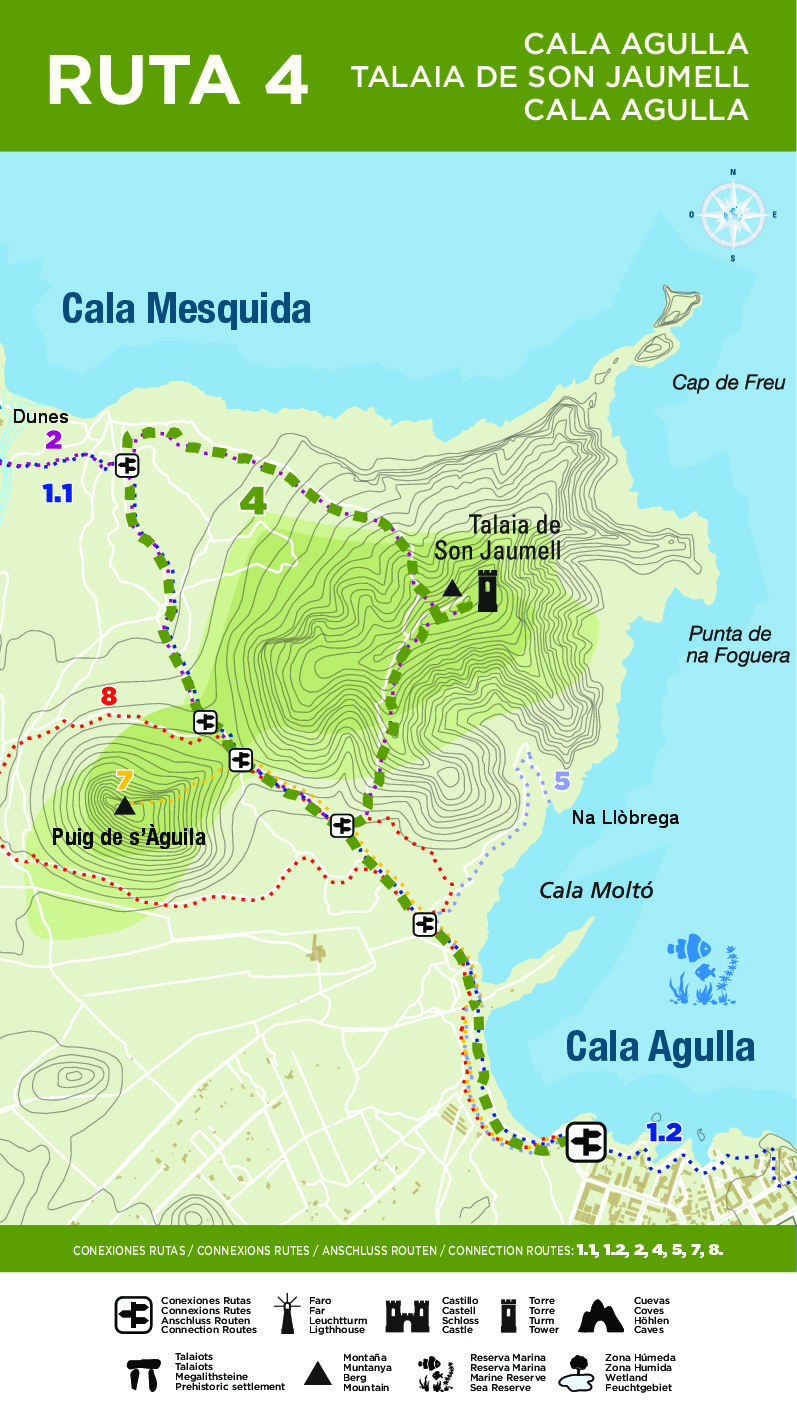
Descubre la Ruta 4
Inicio en
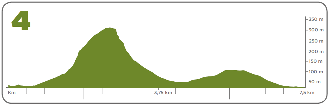
Ruta circular. Desde la rotonda de Cala Agulla cruzamos toda la playa hasta la zona de pinar del fondo. Subimos por el camino del Coll de Marina, dejando a nuestra derecha Cala Moltó, de aguas cristalinas. A unos 500 m encontramos un desvío hacia la derecha, e iniciamos el verdadero ascenso por el interior del bosque, hasta llegar a la Talaia de Son Jaumell. Ya de regreso, por la cara norte, el primer tramo de descenso tiene algunas rampas con alta dificultad. Es imprescindible, pues, el uso de calzado de montaña. El bello sendero de bajada nos dejará ante la playa de Cala Mesquida. Y una vez ahí, tomaremos el camino de la izquierda, por el que llegaremos de nuevo a Cala Agulla por el mismo Coll de Marina