Descubre la Ruta 2
Inicio en
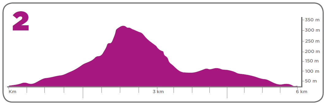
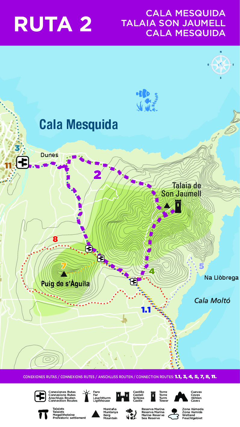
Ruta circular. Se inicia desde la playa de Cala Mesquida, atravesando la pasarela de madera, entre las dunas. Continuaremos hasta llegar al muro que nos separa con la zona de Son Jaumell, donde tomaremos a la izquierda un pequeño camino, a partir del cual seguiremos los hitos indicativos, ascendiendo por la cara norte de la montaña de Son Jaumell, hasta la atalaya, que ofrece una panorámica única. (El ascenso tiene algunas rampas con cierta dificultad y el terreno es muy rocoso). Una vez en la atalaya se nos presentan dos opciones para el descenso: desandar el camino anterior o hacerlo por la cara oeste de la montaña, que nos llevará al Coll de Marina (ruta 1.1). Una vez en él tomaremos a la derecha, en dirección a Cala Mesquida.